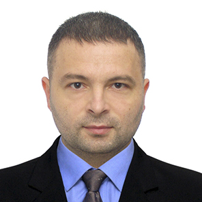
PhD in Agricultural Sciences, Senior Researcher
Coordinator for International Cooperation
Koliada Valerii Petrovych
+38(099)094-82-47Leading scientists

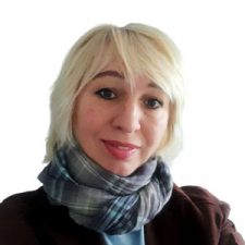
Doctor of Agricultural Sciences, Senior Researcher
Byndych Tatiana Yuriivna
+38(066)305-32-95

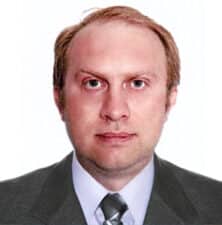
PhD in Biological Sciences
Трускавецький Станіслав Романович
+38(050)643-88-85
Main areas of scientific activity
- Creation of a scientific basis for the state environmental protection policy on soil protection from erosion and deflation.
- Assessment of the risk of erosion processes and the degree of soil erosion degradation.
- Monitoring of water and wind soil erosion
- Development and implementation of landscape-adapted anti-erosion measures.
- Development of theoretical and applied aspects of protection and rational use of soils, taking into account the factors of soil erosion as a calculation basis for the design of soil-protective agro-landscapes in the conditions of agrarian reform.
- Remote monitoring of the condition of agricultural crops. It allows us to receive up-to-date information about the state of crops throughout the entire growing season.
- Comprehensive soil survey of the farm territory using remote and soil methods. It involves several stages.
- Soil survey using RS methods. The modern research method in soil science allows reducing the number of soil samples, saving time and costs for soil analysis. Another advantage is the continuity and relevance of the received data.
- Implementation of precision farming systems - saving fertilizers, increasing yield in heterogeneous areas of fields.
- The laboratory creates nutrient maps for each specific field based on satellite data and laboratory-analytical studies.
- Digital thematic mapping of agricultural land based on space-based imagery.
- Electronic digital maps allow:
- carrying out an analysis of the growing conditions of agricultural crops for each field;
- optimizing production in order to obtain maximum profit, as well as rational use of the territory's resources;
- recording and analyzing the consequences of adverse weather conditions and phenomena, using the data of remote sensing (areas of crops, freezing of areas, pollution)
- Determination of the area of eroded soils:
- for monetary assessment of land plots;
- for evaluation of crop losses;
- for optimization of the structure of the cultivated areas.
The most important research results
- Geosystemic methodology of regulation of erosion processes.
- System of measures to protect agricultural land from erosion and deflation in modern conditions.
- Technology of soil protection optimization of agricultural lands taking into account the features of the relief in modern farming conditions.
- Methodology and computer technology of soil protection examination of land management projects.
- Methods of quantitative assessment and monitoring of erosion-prone lands (soils) using remote sensing methods based on geoinformational principles.
- Determination of soil erodibility by the degree of soil humus-forming potential.
- Modern (latest) technologies for the protection of erosionally and deflationally dangerous lands of the main soil and climatic zones of Ukraine for land users of various forms of ownership.
- Concept of soil protection from erosion in Ukraine.
- Methodical recommendations for the correction of soil-cartographic materials using space surveying;
- Methodical recommendations for mapping erosion-prone soils using space photography;
- Methods of quantitative assessment of erosion-hazardous soils using remote sensing methods;
- Methodology for quantitative assessment of the structure of the soil cover based on space imagery.
Main achievements in international activities
Performance of field and chamber work under a joint international project with the company Soil Cares Research (Netherlands) in 2016. As part of the project:
- selection of soil samples for all soil and climatic zones of Ukraine was carried out in accordance with the requirements of the project's customers;
- testing of the operation of the laser scanner of soil samples was carried out;
- results of the analysis of soil samples obtained as a result of scanning with the Soil Cares Research device were compared to the results of the analysis obtained in laboratory conditions.
- participation in the FAO training seminar on saline soil management for 12 countries of the Eurasian region (2017);
- advanced training as part of a postgraduate internship abroad at the University of Social Sciences (UNS International) in Lodz in cooperation with the Central European Academy Studies and Certifications (CEASC) (2017);
- obtaining a certificate of English language proficiency at the B2 level in accordance with the Common European Framework of Reference (CEFR) (2018);
- presentation with the report "SOIL PROTECTION FROM EROSION ON THE LOCAL LEVEL IN KHARKIV REGION" at the Global Symposium on Soil Erosion (GSER-2019) at the UN FAO headquarters, May 15-17, 2019, Rome, Italy.
Specialists of the laboratory are participants in numerous international trainings, conferences and round tables in the field of erosion processes and remote research methods. The results of the work are published annually by the laboratory in publications that are indexed in the international scientific databases Scopus and Web of Science.
Valerii Koliada - PhD (Agricultural Sciences), Member of the International Society for Development and Sustainability (ISDS), specialization - sustainable development of the environment.
Oleksandr Kruglov - PhD of Geological Sciences, Member of the European Geosciences Union (EGU).
Tatiana Byndych - Doctor of Agricultural Sciences, Expert in the Field of Remote Soil Research Methods.
Pavlo Nazarok - PhD of Agricultural Sciences, Expert in the Field of Geospatial Data Modeling.


